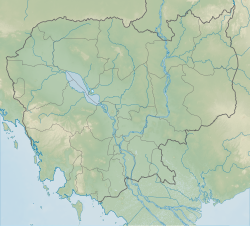
อุทยานแห่งชาติวีรชัย
หน้าตา
| อุทยานแห่งชาติวีรชัย | |
|---|---|
 ทุ่งหญ้า Veal Thom | |
| ที่ตั้ง | จังหวัดรัตนคีรี ประเทศกัมพูชา |
| เมืองใกล้สุด | บานลุง |
| พิกัด | 14°19′33″N 106°59′53″E / 14.32569763°N 106.9981862°E |
| พื้นที่ | 3,380.57 ตารางกิโลเมตร (1,305.25 ตารางไมล์)[1] |
| จัดตั้ง | 1993 |
| หน่วยราชการ | กระทรวงท่องเที่ยว |
อุทยานแห่งชาติวีรชัย (เขมร: ឧទ្យានជាតិវីរជ័យ) เป็นอุทยานที่ตั้งอยู่ในจังหวัดรัตนคีรี ประเทศกัมพูชา มีเนื้อที่ 3,380.57 ตารางกิโลเมตร (1,305.25 ตารางไมล์)[1] อุทยานนี้เป็นหนึ่งในสองอุทยานมรดกอาเซียนของประเทศกัมพูชา[2] โดยกินพื้นที่ทับจังหวัดรัตนคีรีและจังหวัดสตรึงเตรง
อ้างอิง
[แก้]- ↑ 1.0 1.1 1.2 Protected Planet (2018). "Virachey National Park". United Nations Environment World Conservation Monitoring Centre. สืบค้นเมื่อ 26 Dec 2018.
- ↑ "List of ASEAN Heritage Parks". ASEAN Centre for Biodiversity. คลังข้อมูลเก่าเก็บจากแหล่งเดิมเมื่อ 2015-04-02. สืบค้นเมื่อ 2009-08-29.
อ่านเพิ่ม
[แก้]- Baird, Ian G. "Making Spaces: The ethnic Brao people and the international border between Laos and Cambodia" in the journal Geoforum 41 (2010) 271-281
- Baird, Ian G., and Philip Drearden "Biodiversity Conservation and Resource Tenure Regimes: A Case Study from Northeast Cambodia" in the journal Environmental Management Vol. 32, No.5, pp. 541–550
- Bourdier, Frederic. The Mountain of Precious Stones: Ratanakiri, Cambodia. The Center for Khmer Studies, Phnom Penh, 2006.
- Bourdier, Frederic. "Development and Dominion: Indigenous Peoples of Cambodia, Vietnam and Laos." White Lotus Press, Bangkok. 2009.
- "Cambodia's Last Frontier Falls" by Stephen Kurczy in the Asia Times Online.
- Conservation International Preliminary Report 2007

