
ไฟล์:Tierra del Fuego location map.svg

ดูภาพที่มีความละเอียดสูงกว่า ((ไฟล์ SVG, 1,535 × 1,550 พิกเซล, ขนาดไฟล์: 824 กิโลไบต์))
| รูปภาพหรือไฟล์เสียงนี้ ต้นฉบับอยู่ที่ คอมมอนส์ รายละเอียดด้านล่าง เป็นข้อความที่แสดงผลจาก ไฟล์ต้นฉบับในคอมมอนส์
|
ความย่อ
| คำอธิบาย |
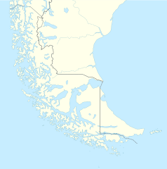
Deutsch: Positionskarte von Feuerland und Umgebung
Quadratische Plattkarte, N-S-Streckung 160 %. Geographische Begrenzung der Karte:
English: Location map of Tierra del Fuego and surroundings
Equirectangular projection, N/S stretching 160 %. Geographic limits of the map:
Español: Ubicación de Tierra del Fuego y alrededores
Proyección equirectangular, N/S 160% de estiramiento. Límites geográficos del mapa:
|
|
| วันที่ | ||
| แหล่งที่มา |
งานของตัว, using
|
|
| ผู้สร้างสรรค์ | NordNordWest | |
| การอนุญาต (การใช้ไฟล์นี้ใหม่) |
ไฟล์นี้อยู่ภายใต้สัญญาอนุญาต ครีเอทีฟคอมมอนส์ แบบแสดงที่มา-อนุญาตแบบเดียวกัน 3.0 ของประเทศเยอรมนี
 ไฟล์นี้อยู่ภายใต้สัญญาอนุญาต ครีเอทีฟคอมมอนส์ แบบแสดงที่มา-อนุญาตแบบเดียวกัน 3.0 ของประเทศเยอรมนี
|
|
| เวอร์ชันอื่น |
ไฟล์อื่นที่ใช้ไฟล์นี้: |

.svg)

|
แผนที่นี้ถูกสร้างหรือพัฒนาขึ้นจาก Kartenwerkstatt (ห้องปฏิบัติการแผนที่) ของวิกิพีเดียภาษาเยอรมัน ซึ่งคุณสามารถเสนอแผนที่เพื่อพัฒนาได้เช่นเดียวกัน
|
ประวัติไฟล์
คลิกวันที่/เวลาเพื่อดูไฟล์ที่ปรากฏในขณะนั้น
| วันที่/เวลา | รูปย่อ | ขนาด | ผู้ใช้ | ความเห็น | |
|---|---|---|---|---|---|
| ปัจจุบัน | 23:20, 5 มีนาคม 2567 | | 1,535 × 1,550 (824 กิโลไบต์) | Janitoalevic | More specific Beagle Channel |
| 08:23, 29 ธันวาคม 2565 |  | 1,535 × 1,550 (588 กิโลไบต์) | Janitoalevic | Improved borders | |
| 02:41, 4 พฤษภาคม 2563 |  | 1,535 × 1,550 (566 กิโลไบต์) | Janitoalevic | Improved Isla de los Estados | |
| 01:47, 4 พฤษภาคม 2563 |  | 1,535 × 1,550 (558 กิโลไบต์) | Janitoalevic | Improved | |
| 06:23, 30 สิงหาคม 2560 |  | 1,535 × 1,550 (441 กิโลไบต์) | Janitoalevic | Fixed size | |
| 18:23, 29 สิงหาคม 2560 |  | 1,535 × 1,550 (510 กิโลไบต์) | NordNordWest | Reverted to version as of 20:59, 15 March 2016 (UTC); change of size is catastrophic to some templates | |
| 05:18, 29 สิงหาคม 2560 |  | 1,638 × 1,653 (442 กิโลไบต์) | Janitoalevic | More precise borders and lakes | |
| 03:59, 16 มีนาคม 2559 |  | 1,535 × 1,550 (510 กิโลไบต์) | Janitoalevic | Fixed limits following Google Earth/maps limits | |
| 05:12, 3 มีนาคม 2559 |  | 1,535 × 1,550 (510 กิโลไบต์) | Janitoalevic | Updated | |
| 03:34, 12 กันยายน 2558 |  | 1,535 × 1,550 (508 กิโลไบต์) | Janitoalevic | Added Southern Patagonian Ice Field (Campo de hielo Patagónico Sur) undefined limits part, since 1998 For more information read: https://en.wikipedia.org/wiki/Southern_Patagonian_Ice_Field#Borderline Now with full resolution. |
หน้าที่มีภาพนี้
หน้าต่อไปนี้ โยงมาที่ภาพนี้:
การใช้ไฟล์ข้ามโครงการ
วิกิอื่นต่อไปนี้ใช้ไฟล์นี้:
- การใช้บน als.wikipedia.org
- การใช้บน ar.wikipedia.org
- การใช้บน az.wikipedia.org
- การใช้บน ba.wikipedia.org
- การใช้บน bn.wikipedia.org
- การใช้บน ceb.wikipedia.org
- การใช้บน cs.wikipedia.org
- การใช้บน da.wikipedia.org
- การใช้บน de.wikipedia.org
- การใช้บน el.wikipedia.org
- การใช้บน en.wikipedia.org
- Tierra del Fuego
- Ushuaia – Malvinas Argentinas International Airport
- Isla Grande de Tierra del Fuego
- Puerto Williams
- Río Grande, Tierra del Fuego
- Diego Ramírez Islands
- Riesco Island
- Hoste Island
- Viedma (volcano)
- Cerro Torre
- Fitz Roy
- Viedma Lake
- Gallegos River
- Mount Darwin (Andes)
- Puerto Toro
- Dawson Island
- Ildefonso Islands
- Hermite Islands
- Southern Patagonian Ice Field
- Navarino Island
- Cordillera Darwin
- Cordillera Sarmiento
- Londonderry Island
- Hornos Island
- Grey Lake
- Desolación Island
- Clarence Island, Chile
- Gordon Island
- Juan Guillermos Island
ดูการใช้ข้ามโครงการเพิ่มเติมของไฟล์นี้