ข้ามไปเนื้อหา

ไฟล์:Maurya Empire, c.250 BCE 2.png

ไม่รองรับเนื้อหาของหน้าในภาษาอื่น
จากวิกิพีเดีย สารานุกรมเสรี

ดูภาพที่มีความละเอียดสูงกว่า(1,200 × 1,121 พิกเซล, ขนาดไฟล์: 2.26 เมกะไบต์, ชนิดไมม์: image/png)

Wikimedia Commons logo รูปภาพหรือไฟล์เสียงนี้ ต้นฉบับอยู่ที่ คอมมอนส์ รายละเอียดด้านล่าง เป็นข้อความที่แสดงผลจาก ไฟล์ต้นฉบับในคอมมอนส์
คอมมอนส์เป็นเว็บไซต์ในโครงการสำหรับเก็บรวบรวมสื่อเสรี ที่ คุณสามารถช่วยได้

ความย่อ

คำอธิบาย
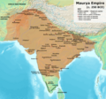
English: Note: This was the standard "textbook" map of the Maurya Empire. Historians are now arguing that the Maurya Empire did not include large parts of India, which were controlled by autonomous tribes. For such a map, see File:Maurya Empire, c.250 BCE.png.
Alternative map of Maurya Empire

Boundaries are based on Charles Joppen Historical Atlas of India (1907), see File:India_in_250_B._C.jpg.

Other Sources:

Other sources:

  • Grainger, John D. (1990, 2014). Seleukos Nikator: Constructing a Hellenistic Kingdom. Routledge.
  • Keay, John (2000). India, a History. New York: Harper Collins Publishers.
  • Kulke, H.; Rothermund, D. (2004). A History of India, 4th, Routledge.
  • Puri, Baji Nath (1996). Buddhism in Central Asia. Delhi: Motilal Banarsidass.
  • Raychaudhuri, H. C.; Mukherjee, B. N. (1996). Political History of Ancient India: From the Accession of Parikshit to the Extinction of the Gupta Dynasty. Oxford University Press.
  • Stein, Burton (1998). A History of India (1st ed.), Oxford: Wiley-Blackwell.

Notes:

  • Sri Lanka and the southernmost parts of India (modern Tamil Nadu and Kerala) remained independent, despite the diplomacy and cultural influence of their larger neighbor to the north (Schwartzberg 1992, p. 18; Kulke & Rothermund 2004, p. 68).
  • The account of Strabo indicates that the western-most territory of the empire extended from the southeastern Hindu Kush, through the region of Kandahar, to coastal Baluchistan south of that (Raychaudhuri & Mukherjee 1996, p. 594).
  • The claim that Aria/Herat was one of the provinces (alongside Arachosia, Gedrosia, and Paropamisadae) ceded by Seleucus to Chandragupta Maurya is often repeated, but Aria (modern Herat) "has been wrongly included in the list of ceded satrapies by some scholars [...] on the basis of wrong assessments of the passage of Strabo [...] and a statement by Pliny." (Raychaudhuri & Mukherjee 1996, p. 594). Seleucus "must [...] have held Aria", and furthermore, his "son Antiochos was active there fifteen years later." (Grainger 2014, p. 109).
  • "The region of Aria is definitely known to have been Seleucid under Seleucus I and Antiochus I as it definitely was after Antiochus III's great campaign in the east against the Parthians and Bactrians. [...] There is no evidence whatever that it did not remain Seleucid, like Drangiana, with which it is linked by easy routes." -Susan M. Sherwin-White and Amélie Kuhrt (1993) From Samarkhand to Sardis: A New Approach to the Seleucid Empire, University of California Press, pp.79-80.
  • It is recorded that Drangiana province continued to be in the Seleucids' hands, as per [1].
  • "Desert of Gedrosia [...] was left an unclaimed wilderness." —Kosmin, Paul J. (2014), The Land of the Elephant Kings Space, Territory, and Ideology in the Seleucid Empire, Harvard University Press, p.16
  • Schwartzberg (p. 18) speculates about the Buddhist culture and Kharosthi inscriptions/manuscripts found in Khotan, but these texts from Khotan, Turfan, and Tajikstan have all been shown to be later than the 1st century BCE (Puri, p. 185).
วันที่
แหล่งที่มา งานของตัว
ผู้สร้างสรรค์ Avantiputra7

การอนุญาตใช้สิทธิ

ข้าพเจ้า ในฐานะผู้ถือลิขสิทธิ์ของภาพหรือสื่อนี้ อนุญาตให้ใช้ภาพหรือสื่อนี้ภายใต้เงื่อนไขต่อไปนี้
w:th:ครีเอทีฟคอมมอนส์
แสดงที่มา อนุญาตแบบเดียวกัน
คุณสามารถ:
  • ที่จะแบ่งปัน – ที่จะทำสำเนา แจกจ่าย และส่งงานดังกล่าวต่อไป
  • ที่จะเรียบเรียงใหม่ – ที่จะดัดแปลงงานดังกล่าว
ภายใต้เงื่อนไขต่อไปนี้:
  • แสดงที่มา – คุณต้องให้เกียรติเจ้าของงานอย่างเหมาะสม โดยเพิ่มลิงก์ไปยังสัญญาอนุญาต และระบุหากมีการเปลี่ยนแปลง คุณอาจทำเช่นนี้ได้ในรูปแบบใดก็ได้ตามควร แต่ต้องไม่ใช่ในลักษณะที่แนะว่าผู้ให้อนุญาตสนับสนุนคุณหรือการใช้งานของคุณ
  • อนุญาตแบบเดียวกัน – หากคุณดัดแปลง เปลี่ยนรูป หรือต่อเติมงานนี้ คุณต้องใช้สัญญาอนุญาตแบบเดียวกันหรือแบบที่เหมือนกับสัญญาอนุญาตที่ใช้กับงานนี้เท่านั้น

คำบรรยายโดยย่อ

เพิ่มคำบรรยายทรรทัดเดียวเพื่อขยายความว่าไฟล์นี้มีอะไร

รายการที่แสดงอยู่ในไฟล์นี้

ประกอบด้วย

media type อังกฤษ

image/png

ประวัติไฟล์

คลิกวันที่/เวลาเพื่อดูไฟล์ที่ปรากฏในขณะนั้น

(ล่าสุด | เก่าสุด) ดู (ใหม่กว่า 10 | ) (10 | 20 | 50 | 100 | 250 | 500)
วันที่/เวลารูปย่อขนาดผู้ใช้ความเห็น
ปัจจุบัน15:27, 27 มิถุนายน 2567รูปย่อสำหรับรุ่นเมื่อ 15:27, 27 มิถุนายน 25671,200 × 1,121 (2.26 เมกะไบต์)Avantiputra7Reverted to version as of 11:01, 30 April 2024 (UTC) - vandalism
15:52, 19 มิถุนายน 2567รูปย่อสำหรับรุ่นเมื่อ 15:52, 19 มิถุนายน 25671,200 × 1,121 (2.18 เมกะไบต์)Chakravartin1929Reverted to version as of 07:37, 14 April 2024 (UTC) This version is not even based on joppen's map. It's westernmost lands clearly dont match with that of joppen's map hence reverting to this.
18:01, 30 เมษายน 2567รูปย่อสำหรับรุ่นเมื่อ 18:01, 30 เมษายน 25671,200 × 1,121 (2.26 เมกะไบต์)Avantiputra7western borders: see talk page
11:37, 16 เมษายน 2567รูปย่อสำหรับรุ่นเมื่อ 11:37, 16 เมษายน 25671,200 × 1,121 (2.26 เมกะไบต์)Avantiputra7Reverted to version as of 11:12, 5 April 2024 (UTC) - vandalism
14:37, 14 เมษายน 2567รูปย่อสำหรับรุ่นเมื่อ 14:37, 14 เมษายน 25671,200 × 1,121 (2.18 เมกะไบต์)Layman7676Reverted to version as of 11:12, 4 April 2024 (UTC) The map you are publishing isn't based on wha vincient Arthur really said.
18:12, 5 เมษายน 2567รูปย่อสำหรับรุ่นเมื่อ 18:12, 5 เมษายน 25671,200 × 1,121 (2.26 เมกะไบต์)Avantiputra7Reverted to version as of 08:27, 3 April 2024 (UTC) - vandalism
18:12, 4 เมษายน 2567รูปย่อสำหรับรุ่นเมื่อ 18:12, 4 เมษายน 25671,200 × 1,121 (2.18 เมกะไบต์)Chakravartin1929Reverted to version as of 05:41, 26 March 2024 (UTC) This is the true map. It depicts The mauryan map accurately.
15:27, 3 เมษายน 2567รูปย่อสำหรับรุ่นเมื่อ 15:27, 3 เมษายน 25671,200 × 1,121 (2.26 เมกะไบต์)Avantiputra7Reverted to version as of 11:06, 3 March 2024 (UTC)
12:41, 26 มีนาคม 2567รูปย่อสำหรับรุ่นเมื่อ 12:41, 26 มีนาคม 25671,200 × 1,121 (2.18 เมกะไบต์)Chakravartin1929Reverted to version as of 09:06, 3 March 2024 (UTC)
18:06, 3 มีนาคม 2567รูปย่อสำหรับรุ่นเมื่อ 18:06, 3 มีนาคม 25671,200 × 1,121 (2.26 เมกะไบต์)Avantiputra7Reverted to version as of 11:10, 29 January 2024 (UTC)
(ล่าสุด | เก่าสุด) ดู (ใหม่กว่า 10 | ) (10 | 20 | 50 | 100 | 250 | 500)

การใช้ไฟล์ข้ามโครงการ

วิกิอื่นต่อไปนี้ใช้ไฟล์นี้:

ดูการใช้ข้ามโครงการเพิ่มเติมของไฟล์นี้

ข้อมูลเกี่ยวกับภาพ