
ไฟล์:012 035 Ile Mingan Niapiscau.jpg
ดูภาพที่มีความละเอียดสูงกว่า (2,698 × 4,149 พิกเซล, ขนาดไฟล์: 3.98 เมกะไบต์, ชนิดไมม์: image/jpeg)
| รูปภาพหรือไฟล์เสียงนี้ ต้นฉบับอยู่ที่ คอมมอนส์ รายละเอียดด้านล่าง เป็นข้อความที่แสดงผลจาก ไฟล์ต้นฉบับในคอมมอนส์
|
ความย่อ
| คำอธิบาย |
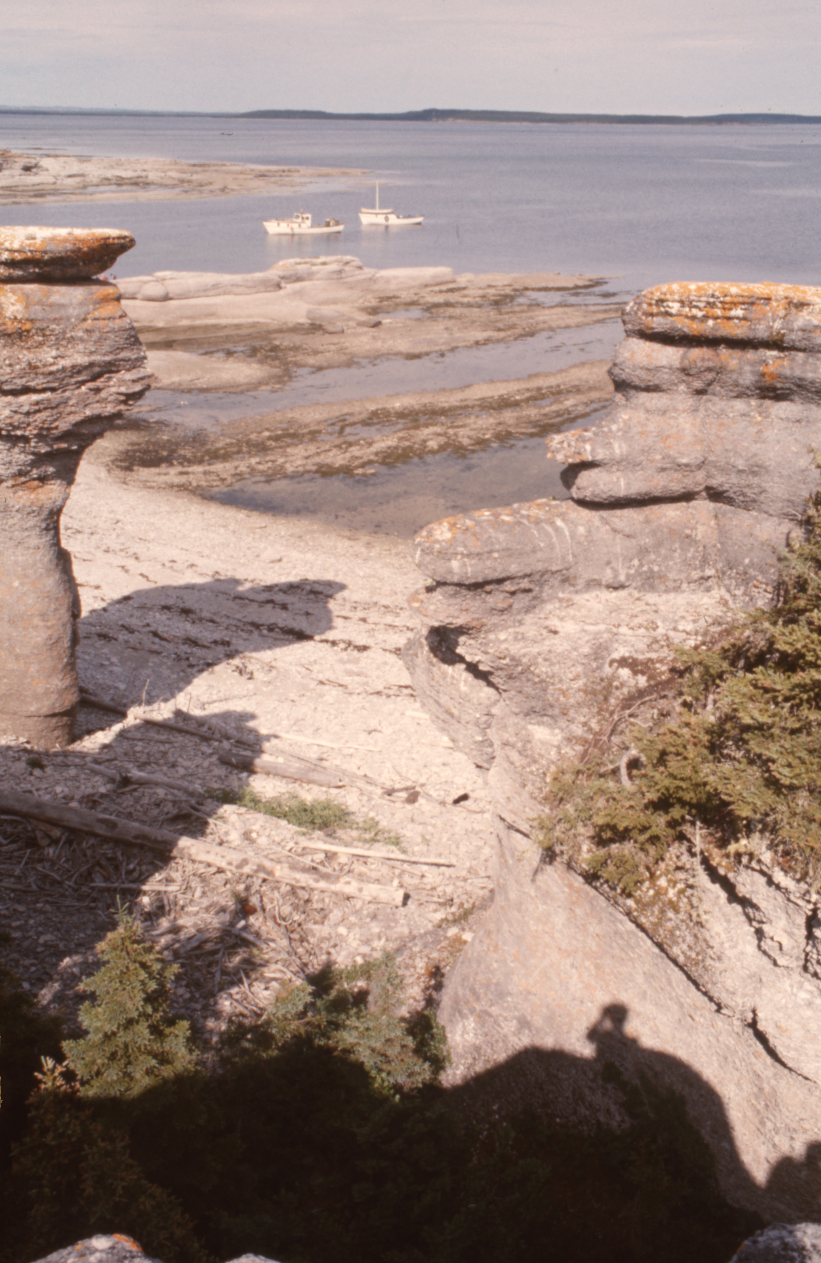
English: 50° 12' 10.0"N - -63° 28' 47.0"W, MRC Minganie, islands of the Mingan archipelago, limestone formations, boreal forest, Gulf of St. Lawrence, aboard the boat of Patrice Lebrun, guide and captain of the excursion, resident of Havre-Saint-Pierre and his family, Tuesday, July 20, 1976.
Français : 50° 12' 10.0"N - -63° 28' 47.0"O, MRC Minganie, îles de l'archipel de Mingan, formations calcaires, forêt boréale, golfe Saint-Laurent, à bord de la chaloupe de Patrice Lebrun, guide et capitaine de l’excursion, résident de Havre-Saint-Pierre et sa famille, le mardi 20 juillet 1976. |
| วันที่ | |
| แหล่งที่มา | งานของตัว |
| ผู้สร้างสรรค์ | Nichole Ouellette |
| ตำแหน่งที่ตั้งกล้อง | | ภาพนี้และภาพอื่น ๆ ณ สถานที่เดียวกันที่ OpenStreetMap |
|---|
- More infos/photos, same author: ouellette001.com/
- Québec en photos – Réserve de parc national de l'Archipel-de-Mingan juillet 1976
- Golfe du Saint-Laurent, À bord de la chaloupe, bateau de plaisance
- Îles - îlots - rochers - cayes – récifs
- Îles - îlots - rochers - cayes – récifs
- Quarry, la mer, des îles
Excursion to the heritage site of the Mingan Archipelago, in a rowboat by Patrice Lebrun with his wife Hélène Turbis, his daughter Marilyne, his son Yvan, Guy Lapointe, our sons Jean-Bruno and Jean-Frédéric and me Nichole Ouellette The section of route 138 from Sept-Îles to Havre-Saint-Pierre opened in the spring of 1976. In July, we were among the first tourists to arrive by road, family, car and tent-trailer, the welcome was exceptional, a mixture of curiosity, hospitality, benevolence combined with a touch of incredulous distrust. We were amazed and won over by our contributor to this article
การอนุญาตใช้สิทธิ
- คุณสามารถ:
- ที่จะแบ่งปัน – ที่จะทำสำเนา แจกจ่าย และส่งงานดังกล่าวต่อไป
- ที่จะเรียบเรียงใหม่ – ที่จะดัดแปลงงานดังกล่าว
- ภายใต้เงื่อนไขต่อไปนี้:
- แสดงที่มา – คุณต้องให้เกียรติเจ้าของงานอย่างเหมาะสม โดยเพิ่มลิงก์ไปยังสัญญาอนุญาต และระบุหากมีการเปลี่ยนแปลง คุณอาจทำเช่นนี้ได้ในรูปแบบใดก็ได้ตามควร แต่ต้องไม่ใช่ในลักษณะที่แนะว่าผู้ให้อนุญาตสนับสนุนคุณหรือการใช้งานของคุณ
ประวัติไฟล์
คลิกวันที่/เวลาเพื่อดูไฟล์ที่ปรากฏในขณะนั้น
| วันที่/เวลา | รูปย่อ | ขนาด | ผู้ใช้ | ความเห็น | |
|---|---|---|---|---|---|
| ปัจจุบัน | 19:40, 13 มกราคม 2567 | | 2,698 × 4,149 (3.98 เมกะไบต์) | Nichole Ouellette | Uploaded own work with UploadWizard |
หน้าที่มีภาพนี้
หน้าต่อไปนี้ โยงมาที่ภาพนี้:
การใช้ไฟล์ข้ามโครงการ
วิกิอื่นต่อไปนี้ใช้ไฟล์นี้:
- การใช้บน en.wikipedia.org
- การใช้บน fa.wikipedia.org
- การใช้บน fr.wikipedia.org
- การใช้บน ko.wikipedia.org